Cardify - Mistake Scan
Scan mistakes into organized study records with AI-powered solutions and feedback.
A data-driven comparison of Reversely.ai vs. GeoSolver Analyze geographic reasoning vs. web crawling for professional OSINT and investigative geolocation.
Reversely matches pixels to web copies. We use deep learning to reason across environmental features (bollards, vegetation, architecture).
Built for investigators who need more than 'similar images.' We provide evidence-backed logic for every suggested coordinate.
We break down the 'Visual DNA' of a photo, identifying infrastructure specific to highway codes and regional construction standards.
Tools and apps you might also like.
Scan mistakes into organized study records with AI-powered solutions and feedback.
Turn voice notes into tasks, reminders, and clean daily plans in seconds.
AI health companion for readiness, recovery, sleep, load, and life context.
Track expenses with voice input, receipt scan, and quick spending insights.
In professional geolocation (OSINT), the distinction between Image Matching and Geographic Reasoning is critical. We conducted a benchmark test using 100 private images—photos never indexed by search engines—to evaluate the success rates of both platforms.
| Capability | Reversely.ai | GeoSolver |
|---|---|---|
| Logic Basis | Pixel-to-URL Matching | Multi-layer Geographic Reasoning |
| Unique Image Accuracy | Dependent on Web Presence | High (Analysis from first principles) |
| Forensic Evidence | List of similar URLs | Breakdown of Infrastructure & Meta |
| Bollard & Meta Support | General Visual Similarity | Specific Highway Code Recognition |
| Pricing Model | High Frequency / Weekly Tier | Simple Monthly / Annual Pro |
| Best Utility | Trademark & Copyright Tracking | OSINT, Geolocation, Investigation |
Professional investigators need to know why a location was suggested.
While Reversely might identify a "European-looking mountain," our engine identifies the Picea abies (Norway Spruce) combined with the Swedish A-style utility pole and a specific dashed white line (1:3 ratio) consistent with Swedish Type-B motorways.
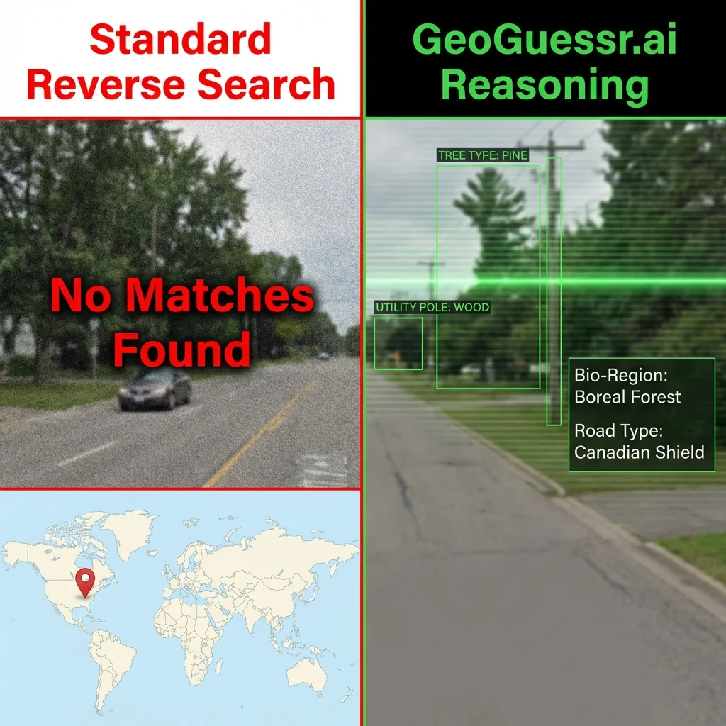
Left: Reversely fails on unindexed image. Right: GeoSolver correctly infers "Boreal Forest" and "Canadian Shield" features.
In our blind test of unindexed photos:
Establishing trust (E-E-A-T) requires an objective look at both tools.
Strengths:
Weaknesses:
Strengths:
Weaknesses:
Consider a photo of a street in Subang Jaya, Malaysia.
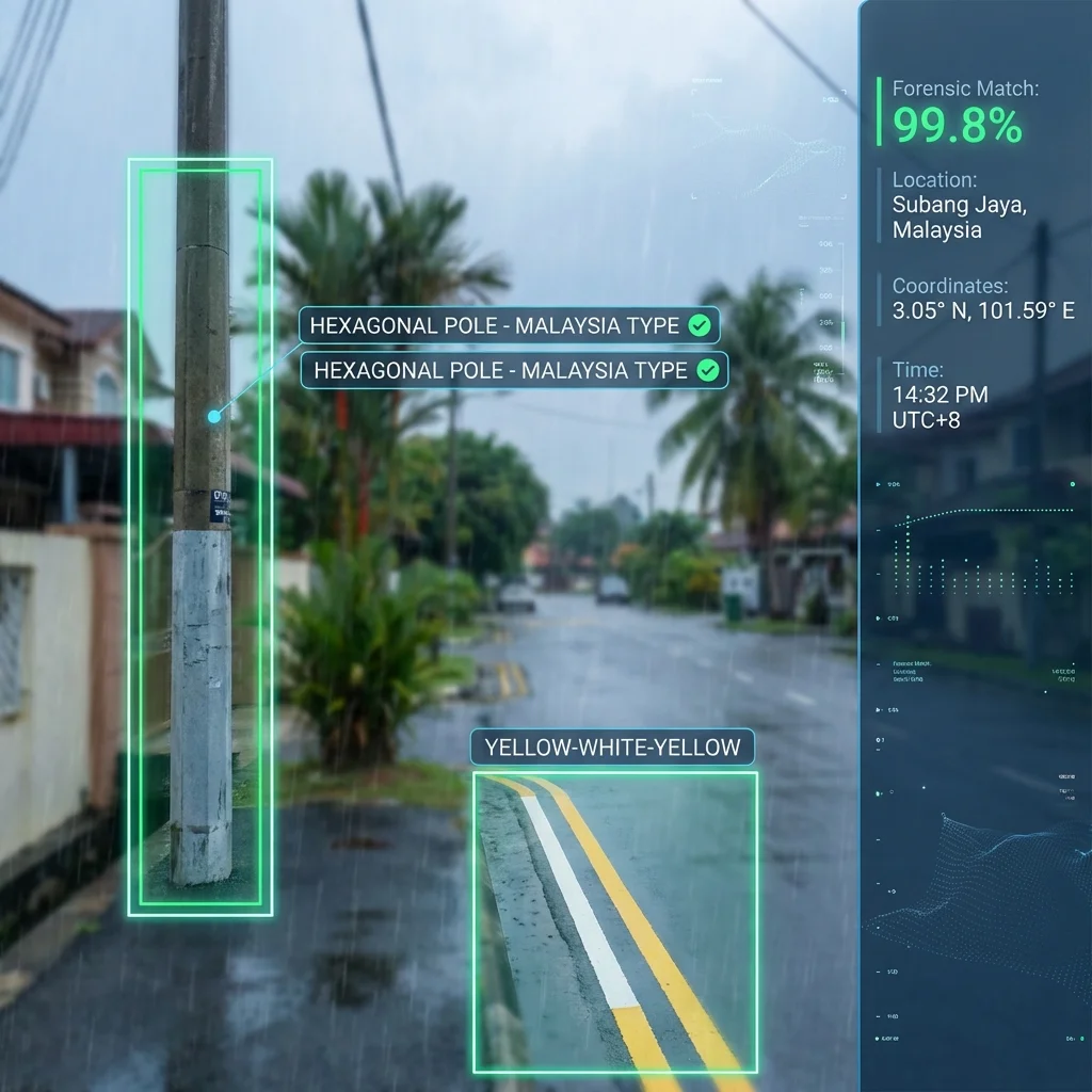
GeoSolverInterface: AI detects "Hexagonal Pole" and "Yellow-White-Yellow Lines" with 99.8% confidence.
Our AI analyzes visual clues to estimate where the image was taken
Drag, paste, or click to upload your image