The Ultimate Guide to Learnable Meta in Geo Games (2026)
This definitive guide breaks down every major category of 'learnable meta'—from the Kenya Snorkel to Polish bollards. Stop guessing, start deducting. Learn the secrets pros use to win.
Introduction: Beyond Guessing, It's a Science
How do top players know they're in rural Kenya in under 10 seconds, with no signs in sight? The answer is one word: Meta. This guide is not a list of scattered tips. It is a complete, structured knowledge system designed to elevate your understanding of Meta from "knowing a few tricks" to "mastering a system."
"Meta" in Geo Games refers to clues that are not from the location's geography itself, but from the way the location was captured by Google's equipment. These are learnable metas: consistent, repeatable patterns that, once learned, can instantly narrow down the world to a specific country or region. By the end of this guide, you won't just be playing a game; you'll be a geographic detective.
If you are still building the basics, read this alongside our Beginner Tips guide. If you want guided practice while you study, use GeoGuessr AI to turn real screenshots into a repeatable training loop.
Table of Contents
Chapter 1: The Camera Meta - Reading the Lens
The Google camera itself is a massive clue, a historical artifact that tells a story. Google has used four main generations of cameras, each with a unique visual fingerprint. For an even deeper technical dive, we highly recommend the excellent guide over at GeoDummy.com.
When a round feels ambiguous, this is exactly the kind of evidence our Geo Solver prioritizes before it starts weighing architecture, vegetation, and road design.
1.1 Camera Generations (Gen 1-4)
-
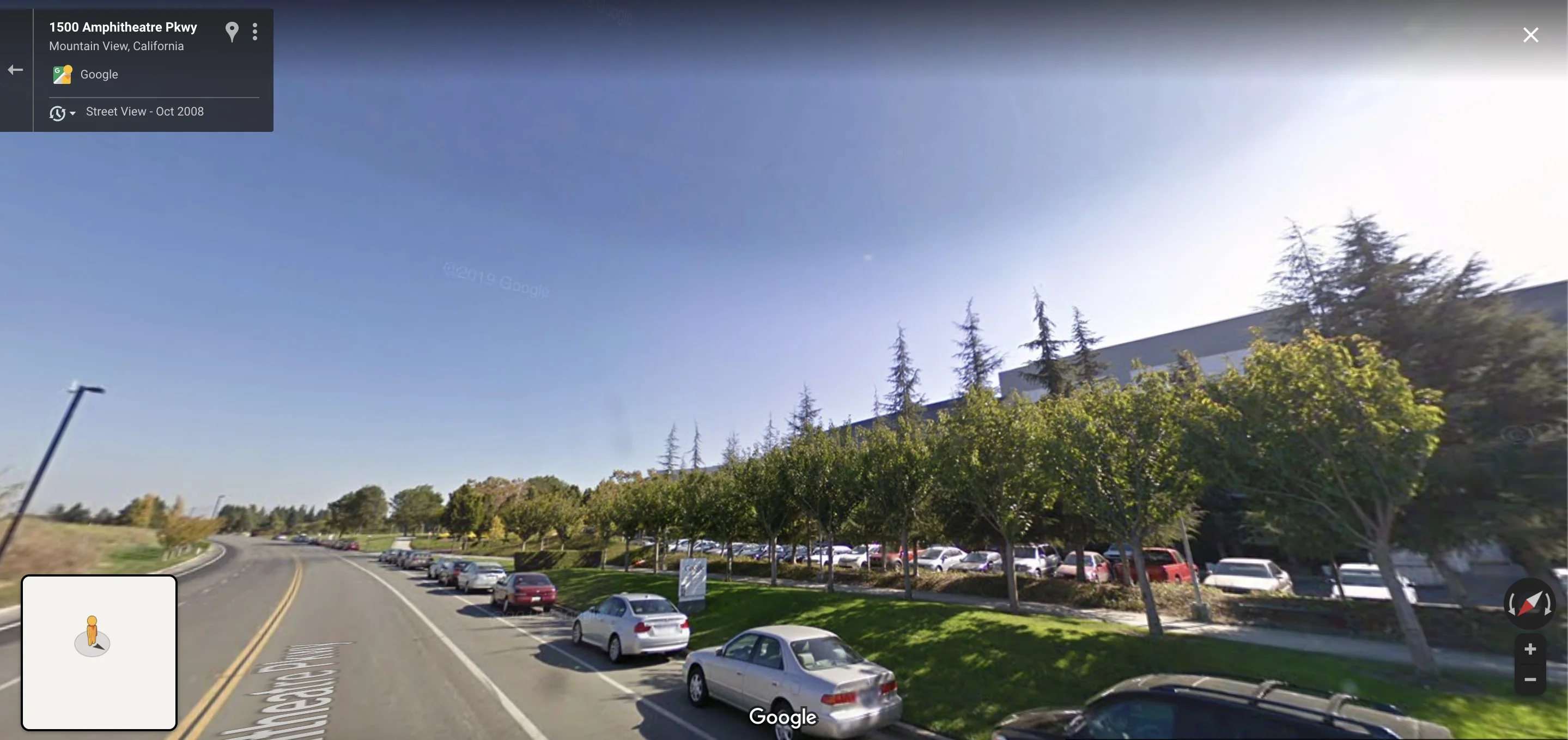
Gen 1: The original. Characterized by very poor image quality, a washed-out, overexposed sky, and often blurry results. Seeing this means you're in very old coverage, typically in the US.

-
Gen 2: The most famous meta. Identified by a massive, often circular "sky rift" or "halo"—a stitching error in the sky. This is a golden clue. If you see it, you are almost certainly in North America, Australia, New Zealand, or parts of Western Europe. It instantly eliminates Africa, most of Asia, and South America.
-
Gen 3: A significant quality upgrade. The colors are more natural, the sky is clear, and the image is much sharper. This is the "standard" look for much of the world's coverage, especially common in Japan and South Africa.

-
Gen 4: The current standard. Ultra-crisp, vibrant, and high-resolution images. The sun often appears as a perfect circle with distinct rays and lens flare. The colors can sometimes feel slightly oversaturated.

1.2 Camera Glitches & Artifacts
Sometimes, the camera itself provides a clue. A common example is a "bottom blur," a persistent blurriness at the very bottom of the screen, which can be a strong indicator for certain European countries like Switzerland or parts of Japan.

For an even deeper, visual dive into camera generations and other national clues, we highly recommend the incredible guides over at PlonkIt.net.
Ready for a Camera Meta Drill?
Upload a screenshot and our AI coach will highlight the camera generation, stitching artifacts, and other subtle cues you may have missed.
Start Camera Meta Drill
Chapter 2: The Car Meta - Clues From Your Own Vehicle
The Street View car you're "in" is one of the most powerful metas. Google uses different vehicles and equipment in different parts of the world. Learning to spot them is a game-changer.
For a dedicated breakdown of snorkels, roof racks, and antenna tells, pair this chapter with our Car Meta guide. It is the fastest way to turn this theory into instant recognition.
2.1 The "A-List" Car Metas: 100% Confirmations
These are the most reliable clues you can find.
-
The Kenya Snorkel: The Google car in Kenya has a massive, black snorkel on its front-right side for crossing rivers. If you see it, you are in Kenya. Period. For a detailed breakdown, read our AI-powered analysis of this legendary meta.

-
The Ghana Roof Rack: The car in Ghana is a black vehicle with a distinctive silver roof rack, often held together with black tape. Another 100% confirmation. See this meta in action in our deconstruction of Rainbolt's genius.

2.2 Busting a Myth: The Real Kyrgyzstan Car Meta
The Geo Game community is constantly evolving, and so are the metas. For years, an old myth circulated about a "red car" in Kyrgyzstan. While some red vehicles exist, the truly reliable, modern meta is something else entirely: the white roof rack.

The Real Clue: According to the definitive guides at PlonkIt.net, the key indicator for Kyrgyzstan is a white car equipped with a white roof rack. Sometimes, you can only see the shadow of this rack on the ground. This is a subtle but far more reliable clue than the mythical "red car."
Can You Spot the Car Meta in Time?
Drop a screenshot into the AI coach and get instant callouts on snorkels, roof racks, and antenna shadows—plus a breakdown of why they matter.
Start Car Meta Drill
Chapter 3: Infrastructure Meta Part 1 - The Roads
Government-standardized road markings are among the most reliable meta clues in Geo Games. Road infrastructure follows national standards, making it an excellent indicator of location. However, the rules for North America are far more nuanced than many players realize. This section draws directly from the expert analysis at PlonkIt.net, the definitive resource for road line meta.
3.1 Road Lines: Understanding North American Center Line Markings
The center line markings on roads are governed by national transportation standards. While many players assume simple rules, the reality is more complex—especially when distinguishing between the United States and Canada. Understanding these nuances is crucial for accurate identification.
3.1.1 The United States: Double Yellow as the Standard
According to the comprehensive Plonk It USA guide, the double yellow center line is the most common and characteristic marking for American roads. This marking consists of two parallel yellow lines running down the center of the road, typically indicating a no-passing zone or a separation between opposing traffic flows.
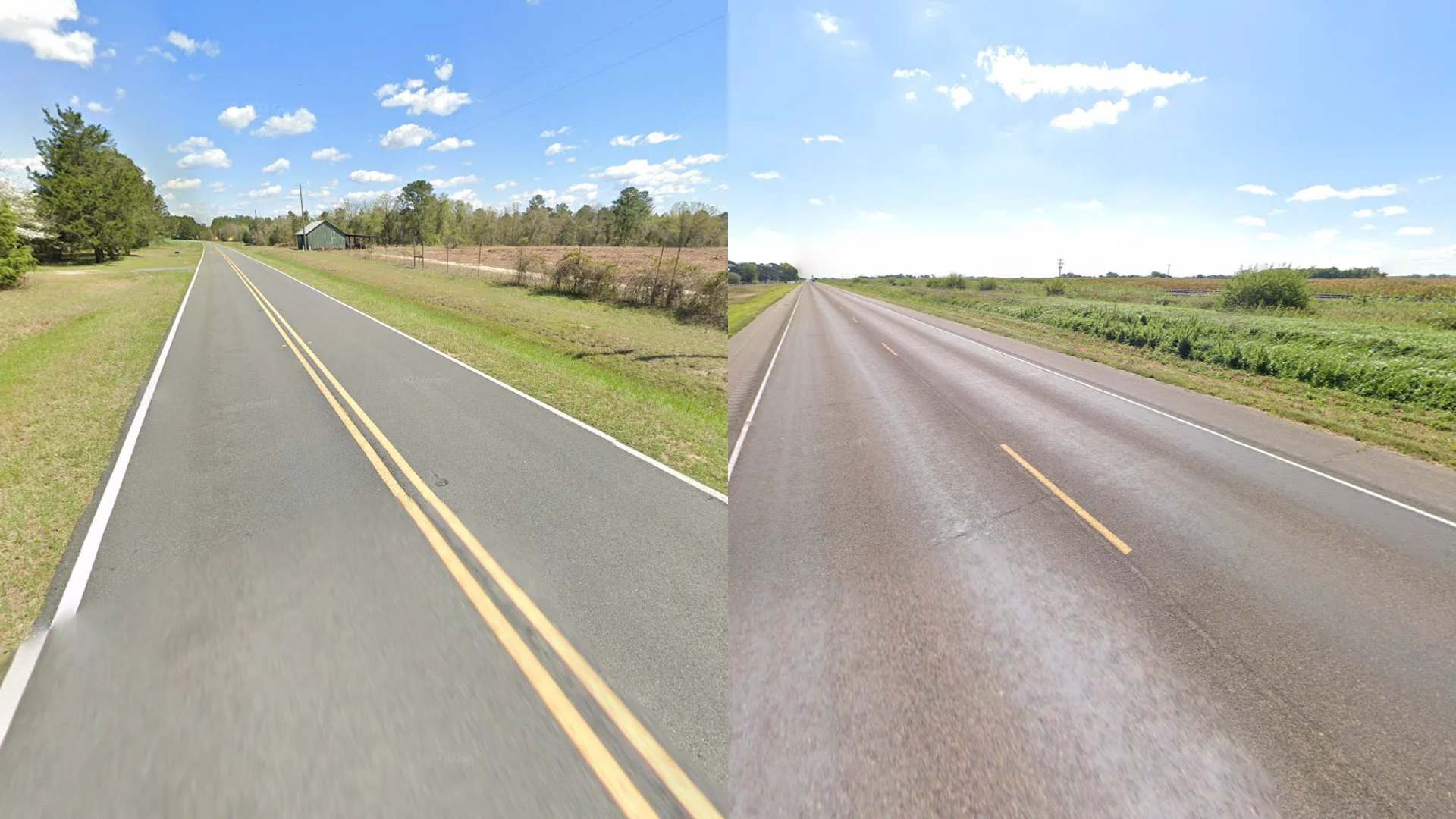
(Image from PlonkIt.net: The characteristic double yellow center line, the most common road marking in the United States.)
The double yellow line is so prevalent in the US that it has become one of the strongest visual indicators for American locations. However, it's important to note that this is not exclusive to the US—which leads us to the Canadian case.
3.1.2 The Canadian Case: A Dual System
The Plonk It Canada guide reveals a more complex picture. Unlike the United States, Canada employs both single and double yellow center line markings, depending on the road type and context.
Single Yellow Center Line: The Canadian Pattern
According to PlonkIt's analysis, Canadian roads usually have single yellow centre lines. These single yellow lines (which may be solid or dashed depending on the road conditions) are more common in Canada than in the United States. However, PlonkIt notes that "double middle yellow centre lines are still decently common" in Canada, creating significant overlap with US road markings.

(Image from PlonkIt.net: A single yellow center line—more common in Canada than in the US. Note that single yellow lines may be solid or dashed depending on road conditions. Double yellow lines are also common in Canada.)
Double Yellow Line: The Overlap
While the double yellow line is characteristic of the US, PlonkIt's Canada guide confirms that double yellow lines can also be seen on wider roads in Canada. This creates a significant overlap between the two countries and highlights why single-line markings are more reliable for identifying Canada.

(Image from PlonkIt.net: A double yellow center line on a wider Canadian road. This overlap with US markings makes additional clues essential for accurate identification.)
3.1.3 The Strategic Approach: How to Use These Clues
Understanding these patterns is only half the battle. Here's how to apply this knowledge strategically:
High-Confidence Indicators:
- Single Yellow Center Line → More likely to be Canada than the US, but not definitive (both countries can have single yellow lines)
- Double Yellow Line → More common in the United States, but also common in Canada, requiring additional confirmation clues
The Critical Rule: Always Seek Confirmation
When you see a double yellow line, don't immediately assume the US. Instead:
-
Look for secondary confirming clues:
- Speed limit signs (US uses mph, Canada uses km/h)
- License plates
- Road signage style
- Other infrastructure meta (bollards, poles, etc.)
-
Consider the road context:
- Wider highways are more likely to have double yellows in both countries
- Narrower rural roads with double yellows lean more toward the US
- Single yellow lines (solid or dashed) are more common in Canada, but this is not a definitive indicator
Why This Matters:
Many players fall into the trap of assuming "double yellow = USA" without considering the overlap. According to PlonkIt, "This is not a 100% reliable clue, so make sure to use this along with other clues." The key is understanding that single yellow lines are more common in Canada, while double yellow lines are more common in the US, but both require additional context clues to confidently distinguish between the two countries.
3.2 Driving Side
The most basic meta. Driving on the left instantly narrows the possibilities to the UK, Ireland, Australia, New Zealand, Japan, India, and parts of Southern Africa and Southeast Asia.
Chapter 4: Infrastructure Meta Part 2 - Bollards & Poles
This category is so important, it deserves its own chapter. For an even more comprehensive analysis, we highly recommend the resources at GeoHints.com.
4.1 Bollards: The Unsung Heroes
Bollards (roadside marker posts) have nationally distinct designs. Here are some of the most iconic ones.

4.1.1 Quick-Reference Matrix
| Country / Region | Primary Colors | Signature Detail | Backup Confirmation |
|---|---|---|---|
| France | White concrete + red cap | Reflective red band wraps entire top | Rounded shoulder, often concrete base |
| Poland | White concrete + single red strip | Stripe on one face only, does not wrap | Often paired with narrow red-topped white posts at intersections |
| Denmark | White body + red mid-band | White reflector embedded inside red band | Slightly wider profile, pristine paint |
| Italy | Black / yellow diagonal stripes | Pattern painted on rectangular metal | Look for narrow rural lanes + guard rails |
| Portugal | Black-and-white curb stones | Painted curb rather than freestanding post | Cobblestone shoulders, palm trees |
| Finland / Sweden | Tall, flexible orange wands | Usually removable winter stakes | Snowbanks, blue km markers |
4.1.2 Workflow to Avoid False Positives
- Scan the profile: rounded vs. flat tells you if it's cast concrete (France) or metal (Italy).
- Check the reflector logic: wrap-around = France/Denmark, single face = Poland.
- Confirm with environment: vegetation + road width often eliminate copycats (e.g., Baltic states copying Polish colors but with forested sand shoulders).
4.1.3 Lookalike Traps
- Baltics vs. Poland: Similar colorway, but Baltic posts are slimmer and often plastic.
- Hungary vs. France: Both use red-topped whites; Hungary's posts are thinner with flat tops.
- Norway vs. Sweden: Both use orange flexible stakes; Norway places them farther from the asphalt edge.
Need a Bollard Spotting Sparring Partner?
Upload any roadside view and let the AI coach circle key bollard features, then quiz you on lookalikes so the patterns stick.
Start Bollard Drill
4.2 Utility Poles: The Hidden Language
The design of utility poles can be a state or country-specific clue.

Pole diagnostics cheat sheet
- South America: Concrete "ladder" poles with evenly spaced holes (Brazil/Colombia).
- Nordics: Tall wooden poles with double top struts plus orange guy wire guards (Norway).
- Japan: Dense cable bundles + gray transformers stacked vertically.
- Philippines: Steel lattice minis with chaotic cable looms.
Pair pole style with insulator color (green ceramic = Balkans) and wire count (triple bundle = high-voltage) to move from "continent guess" to "country confidence."
Chapter 5: The Coverage Meta - Understanding Google's Footprint
An advanced topic. The type of Google coverage can be a clue.
-
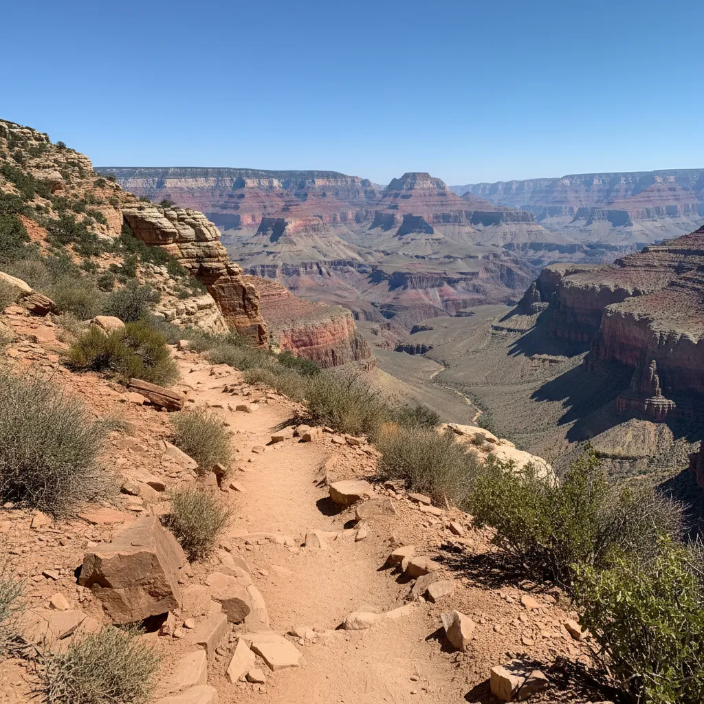
Trekker vs. Car: Trekker coverage (on foot) means you're likely at a famous landmark, national park, or university.
-
Official vs. Unofficial: Germany has very limited official Street View due to privacy laws. If you're in Germany, it's likely old coverage in a major city, or blurry, user-submitted "photospheres." This lack of coverage becomes a clue itself.

5.1 Coverage Windows Cheat Sheet
- 2008-2010 boom: Launch era for the US, Western Europe, Japan. Expect Gen 2 + low sun angles.
- 2011-2016 expansion: South America, South Africa, and Indonesia—spot patchy mosaics and photospheres.
- 2019+ refresh: Ultra-crisp Gen 4, new Balkan coverage, East African highways.
5.2 Triage Workflow
- Zoom on the minimap → Absence of blue lines? Probably a photosphere; pan 360° to spot tripod shadows.
- Check movement → If you can only pivot, you're in Trekker/Photosphere mode; treat metas cautiously.
- Cross-check release notes → Use PlonkIt or GeoHints coverage timelines to see if the country even has the road type you're on.
Validate Coverage The Smart Way
Upload a tricky round with patchy coverage and the AI coach will flag whether it\u2019s Trekker, photosphere, or official Street View\u2014plus which metas remain reliable.
Start Coverage Drill
How to Learn the Meta: Your AI-Powered Training Plan
This is a lot to memorize. The key is systematic practice. But there's a faster way to train your brain. ReverseImageLocation is your personal meta spotter. Our AI coach sees all of this instantly. When you upload a screenshot, our clues analysis will point out the specific Camera Gen, the type of bollard, or the subtle car meta you missed. It's the most efficient way to turn this guide's knowledge into your own skill.
Suggested 3-step loop
- Identify: Skim a chapter, then write down the 3 highest-confidence tells you didn't already know.
- Quiz: Upload 5 screenshots featuring that meta and let the AI highlight/label them. Hide the labels and re-answer.
- Reinforce: Log the misses in a personal spreadsheet (meta, country, why it failed) and revisit weekly.
Weekly progression template
- Week 1: Camera Gen + Driving Side (fastest global filters).
- Week 2: Car metas (Kenya/Ghana/Kyrgyzstan) + Bollards (France/Poland/Denmark).
- Week 3: Road lines + coverage tricks (Trekker vs. Car, official gaps).
- Week 4: Mix all categories, repeat uploads until you can name the meta within 3 seconds.
Turn This Guide Into Muscle Memory
Use the upload anchor on the homepage to run targeted drills. Tag each upload (e.g., \u201cCamera Gen\u201d or \u201cBollards\u201d) so you can measure which metas stick fastest.
Start Training Drill
Frequently Asked Questions
1. Is learning meta considered cheating?
No. Learning meta is the essence of high-level Geo Game play. It's skill, not cheating. However, using a tool during a competitive match is against the rules. For the sanctioned way to practice, see How to Learn the Meta. Read our full article on this topic here.
2. What is the easiest meta to learn for beginners?
Start with the "big two": Driving Side basics (left vs. right) and the Gen 2 Camera "sky rift" from the Camera Meta section. These two clues alone can solve a huge number of rounds. Our Beginner's Guide covers this in more detail.
3. How does the ReverseImageLocation coach help with learning metas?
Our AI doesn't just give you an answer. It provides a full, structured report explaining why a location is what it is, pointing out the exact meta clues. It's like having a pro player as your personal tutor—see How to Learn the Meta for the full workflow and drill templates.
Tools, Guides, and Articles for This Topic
Move from reading into action with the most relevant solver pages, learnable meta guides, and supporting articles.
Explore the complete GeoGuessr AI hub for ai geoguessr, geoguesser ai, and geoguessr ai solver searches. Compare tools, learn the meta, and pick the best workflow.
Use our advanced GeoGuessr solver for NMPZ, rural rounds, and hard snapshots. Built for players who need deep meta reasoning, not just a broad GeoGuessr AI overview.
Meet the world's most advanced GeoGuessr AI bot. Safer than scripts, our automated AI assistant provides real-time coaching and geographic reasoning without risking your account.
Master the most reliable meta in Geo Games. A complete guide to identifying countries by their traffic bollards.
Master Google Street View car meta for GeoGuessr. Identify countries by snorkels, roof racks, tape, mirrors, antennas, camera generations, and car blur.
Identify GeoGuessr bollards by country with visual examples for France, Poland, Denmark, Germany, Italy, Peru, Australia, and more.
We took Rainbolt's most legendary 0.1-second guesses and ran them through our AI Coach. The results reveal the science behind the magic. This is how he wins.